INFOMAR: Mapping the seabed to shape a sustainable ocean economy
Each month, an expert from the Marine Institute will shine a light on their area of work, sharing insights on our ocean knowledge. As the national agency responsible for supporting the sustainable development of our marine resources, the Marine Institute delivers scientific knowledge, expert advice and services to government, industry and a wide range of stakeholders.
This month, Thomas Furey, Section Manager, Advanced Mapping Services at Marine Institute, and Joint Project Manager of INFOMAR, reflects on how the work of the INFOMAR programme has transformed our understanding of Ireland's seas.
INFOMAR: Mapping the seabed to shape a sustainable ocean economy

Ireland's designated continental shelf is ten times the size of its landmass. For most of history, much of what lies beneath that vast stretch of ocean remained unknown. INFOMAR - the Integrated Mapping for the Sustainable Development of Ireland's Marine Resources programme - has been changing that since 2006.
On April 30th, Minister Darragh O'Brien announced that the Department of Climate, Energy and Environment (DCEE) has secured government approval for the final phase of INFOMAR, running from 2027 to 2029. When complete, Ireland will have a comprehensive, high-resolution map of its entire shelf and coastal marine territory - a scientific achievement that enables real-life advancements for fisheries, renewable energy, and marine biodiversity stewardship.
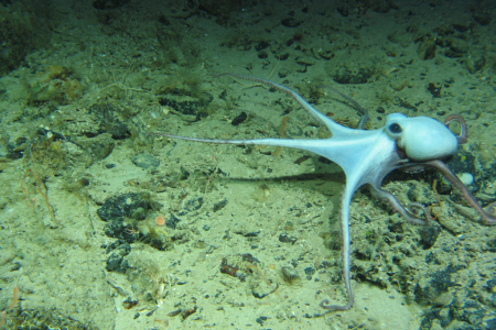
INFOMAR is jointly delivered by the Marine Institute and Geological Survey Ireland and funded by DCEE. Using Ireland's national research vessels, primarily the RV Tom Crean for offshore mapping, the programme surveys the seabed using advanced multibeam sonar systems, measuring depth, sediment type, and biological features of the ocean floor with extraordinary precision. The RV Tom Crean typically operates around the clock, spending 70 to 80 days mapping at sea each year.
The result of Ireland’s seabed mapping endeavour is the Real Map of Ireland, a high-resolution picture of what lies beneath Ireland's waters.
Knowing exactly what lies on the seabed means that fisheries management discussions can be grounded in facts rather than assumptions. When fishers, scientists and planners sit down together to discuss how Ireland's seas should be managed, INFOMAR data gives fishing communities a clear, evidence-based foundation from which to engage and shift the focus to working together toward shared solutions, rather than debating what might or might not be true about the seabed.
INFOMAR data has already been used for seabed substrate maps that have pinpointed the exact location of herring spawning grounds. These findings have been validated by the fishing industry and are being integrated in marine spatial planning decisions aiming to protect those spawning grounds. INFOMAR data has also been used to better understand the connectivity between Norwegian lobster populations around Ireland, supporting more informed and sustainable management of one of Ireland's most valuable fisheries.
However, the impact of INFOMAR extends beyond fisheries. INFOMAR data provides a crucial evidence base to support the implementation of Ireland's Climate Action Plan, the National Marine Planning Framework, and the development of Ireland's offshore renewable energy sector. It has helped identify 420 shipwrecks, de-risking net snagging and protecting lives at sea, while providing deeper insight into Ireland’s heritage. The seabed map will also help design optimal pathways for future telecommunications cables and energy interconnectors.
At the heart of INFOMAR is a commitment to making all data freely and publicly accessible. This principle is key to transparent decision-making: When the scientific evidence underpinning planning and management decisions is openly available to all, from fishers and communities to developers and policymakers, it creates the conditions for fairer, better-informed decisions.
A new Seabed Observation Data Portal, currently nearing completion, will make it easier than ever to access, compare, and analyse Ireland's marine data through a single, free online mapping interface.
With INFOMAR heading toward its completion in 2029, the Marine Institute will work with its partners towards scoping and specifying future marine data requirements and enhancing data availability as part of the marine evidence base for the Government and all marine stakeholders.
As society’s demand for seafood, offshore renewable energy, port infrastructure, and marine tourism continue to expand, INFOMAR data - and the seabed knowledge it has helped us to build - will underpin sound decision making on the value, use, and protection of Ireland’s maritime resources.
This article first appeared in The Marine Times (May 2026).
INFOMAR is Ireland’s national seabed mapping programme and is funded by the Department of Climate, Energy and the environment (DCEE) It is jointly managed by Geological Survey Ireland and Marine Institute and is tasked with fully mapping Ireland’s territorial waters for the sustainable development of Ireland’s marine resource.
INFOMAR will continue until the end of 2026, enabling effective management and accelerated growth to support Harnessing Our Ocean Wealth.